The council knew. This is what was asked for instead.
Killardry Bridge crosses the River Aherlow at Kilmoyler, in the Cahir electoral area. In the year before Bronagh English died there on 24 April 2025, Tipperary County Council's own engineers inspected this bridge twice and recorded, in the council's own words, that it was in a dangerous condition. This page sets that documented knowledge beside the record of what was actually asked of the council for Kilmoyler in 2025 — before Bronagh died, and after. Every quotation is taken word-for-word from the council's own reports and its adopted minutes. Nothing is added to them.
Knowing the condition of a public bridge, and keeping it safe, is the statutory responsibility of the road authority — here, Tipperary County Council. The inspections quoted below are the council's own: the council commissioned them and paid for them, and the January 2025 report that recorded 'Significant Damage' was carried out for the council itself. This was not information the council lacked. It was the council's own knowledge, of its own bridge, obtained at its own expense.
Tipperary — the highest road-death toll of any county in Ireland, 2023
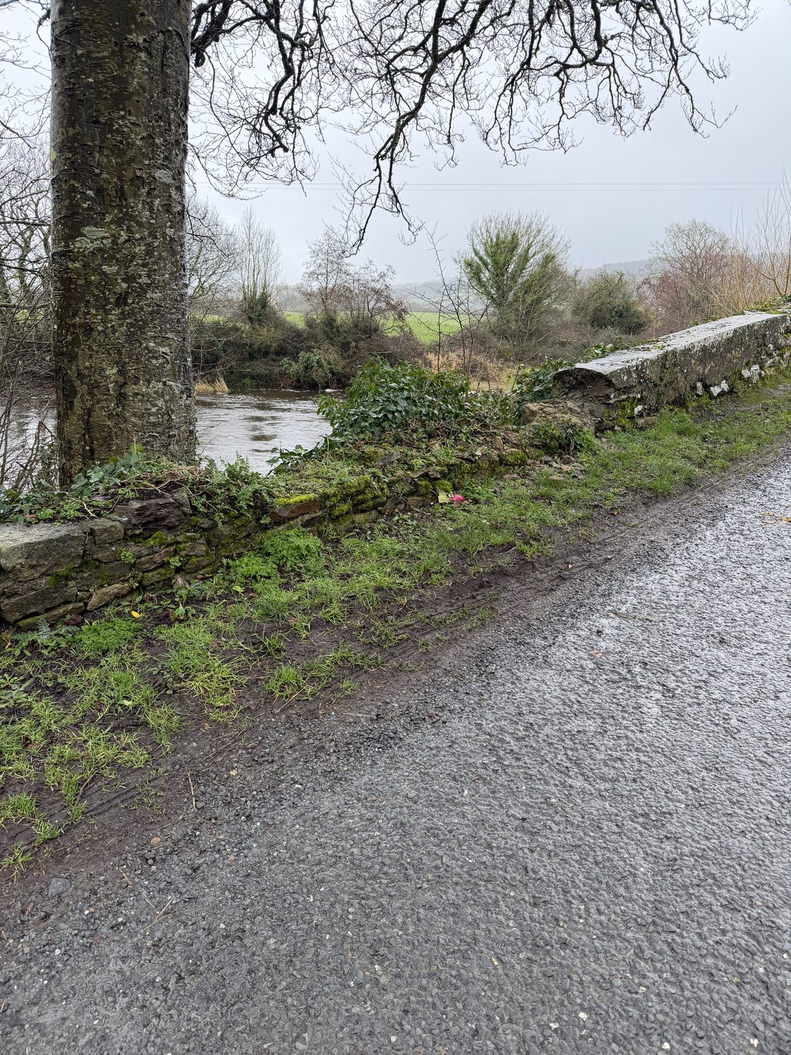
The capping removed — as recorded in the council’s engineering inspection of 21 January 2025 — the wall standing barely above the road, the river beyond. Photograph: family, 2026. Road-death ranking: Road Safety Authority, “Road Deaths in 2023 Increase by 19%” (1 January 2024), county table — Tipperary recorded 16, the most of any county.
What the council knew — from its own engineers
2014 — priced, and scheduled
The council's own bridge inspection recorded loose and missing stones on both parapets and priced the repair: €200 of masonry repair and €250 of repointing — €450 in total, scheduled for 2017. The report set the next inspection for 2016.
Principal (Eirspan) inspection, bridge ref TS-LP3101-001, report 4 March 2014.
The 2016 inspection was never done
The 2016 inspection the 2014 report had ordered was not carried out. The council's own later review records the reason: 'Sufficient funding was not available for inspection of the bridge in 2016, and no subsequent inspection took place.' The €450 parapet repair was never carried out.
A council maintenance inspection rated the bridge 'Warning' overall — abutments, piers and vegetation rated 'Warning'. No comments were recorded, and no repair work followed.
TCC maintenance inspection, 20 June 2024, bridge record TY-L3151-B-010.
21 January 2025 — 'Significant Damage' (93 days before)
A consulting engineer inspecting for the council rated the bridge 'Significant Damage'. In the council's own record: a five-metre length of parapet wall had collapsed; four areas of stonework were missing on the upstream wall and two downstream; 'the capping of the downstream wall has been partly removed'; and a major abutment crack 'should be underpinned and repointed as soon as possible'. The record's own summary: 'Work required to abutment … walls and parapet walls.' This was ninety-three days before Bronagh died at that wall.
The council paid €19,518.50 for this January 2025 inspection — the inspection that recorded the bridge as dangerous. The repair its own 2014 report had priced at €450 was never carried out.
TCC engineering inspection, 21 January 2025, bridge record TY-L3151-B-010. Engineer's invoice for the 21 January 2025 inspection, held on file; 2014 repair cost per the Principal inspection report, 4 March 2014. See the inspection record.
What was asked for at Kilmoyler
24 February 2025 — one month after 'Significant Damage'
"Councillor McGrath referred to the Climate and Flood Relief Funding available and asked if the issues at Kilmoyler could be addressed with this Scheme."
Tipperary–Cahir–Cashel Municipal District, adopted minutes, 24 February 2025.
The Kilmoyler project pursued under this funding was road works — resealing and flood-alleviation on the roadway — not a repair of the parapet the council's own engineer had rated 'Significant Damage' five weeks earlier. (Council climate-adaptation allocation, project T/CCAR/25/019, road L-31011-0.)
24 April 2025
Bronagh English died at Killardry Bridge, Kilmoyler. She was eighteen. The forensic report records fatal contact with the parapet wall.
26 May 2025 — one month after Bronagh died
"Councillor McGrath sought an update in relation [to] the climate change funding works at Kilmoyler."
Tipperary–Cahir–Cashel Municipal District, adopted minutes, 26 May 2025.
In the same meeting, another councillor referred to 'the recent tragic incident and requested safety measures be put in place'. The adopted minutes do not record Councillor McGrath commenting on it. Her own safety request that day concerned a school warden.
23 June 2025 — two months after Bronagh died
"Councillor McGrath inquired about the timeline for the surface dressing in the Cahir area and whether the Kilmoyler project, under Climate Change Funding, was going ahead as this would alleviate flooding."
Tipperary–Cahir–Cashel Municipal District, adopted minutes, 23 June 2025.
The balance of the record
Across the council's 2024 and 2025 minutes, the record shows Councillor McGrath raising Kilmoyler climate and flood funding three times — in February, May and June 2025. Across the same record, the number of times she is recorded seeking the repair of the Killardry Bridge parapet, or raising its structural safety, is none. The €450 repair the council's own 2014 report had priced, and the 'Significant Damage' its own engineer recorded in January 2025, are not, on this record, the subject of a single request to fix them.
Ireland’s worst county for road deaths — then a vote against the lower limit
In 2023, Tipperary recorded the highest number of road deaths of any county in Ireland — 16 in the year. Road Safety Authority, “Road Deaths in 2023 Increase by 19%” (1 January 2024), county table.
Nine months later, on 14 October 2024, Tipperary County Council unanimously agreed a motion (Notice of Motion Ref. 2861) that the incoming 60 km/h default limit for rural local roads should “not be universal across this County, but apply only in areas deemed necessary by this Council.” The motion was proposed by Cllr Niall Dennehy and seconded by Cllr Máirín McGrath — the same councillor whose Kilmoyler requests, across 2025, were for climate and flood funding, and never for the repair of the collapsed parapet at Killardry Bridge.
The reduced limit came into force regardless on 7 February 2025. On 24 April 2025 Bronagh English died at Killardry Bridge, on a bend her family’s forensic engineers put at a safe wet speed of about 46 km/h — below even the new 60 limit — with no warning sign of any kind. The council had, by its own inspection of 21 January 2025, already recorded that bridge’s parapet collapsed and its signage absent, and had done nothing in the 93 days before she died.
Motion recorded verbatim in the adopted Minutes of Proceedings of Tipperary County Council’s monthly meeting of 14 October 2024 (Ref. 2861; held on file); also reported by Tipp FM (15 October 2024) and the Midland Tribune / Offaly Express. Road-death ranking: RSA, 1 January 2024. Safe-speed figure: family forensic survey. Bridge condition and signage: TCC engineering inspection, 21 January 2025 (TY-L3151-B-010). The motion was carried at full County Council, not the Cahir–Cashel district specifically; it concerned how the new limits would be applied, and the reduction proceeded.
What the council said had been done — and what these photographs show
Asked what works it had carried out at this location, Tipperary County Council’s account, in its FOI internal review, was that its only drainage activity was “routine verge-inlet cleaning,” and that there were “no specific drainage works carried out on the bridge itself.”
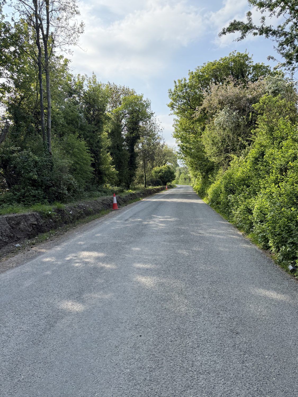
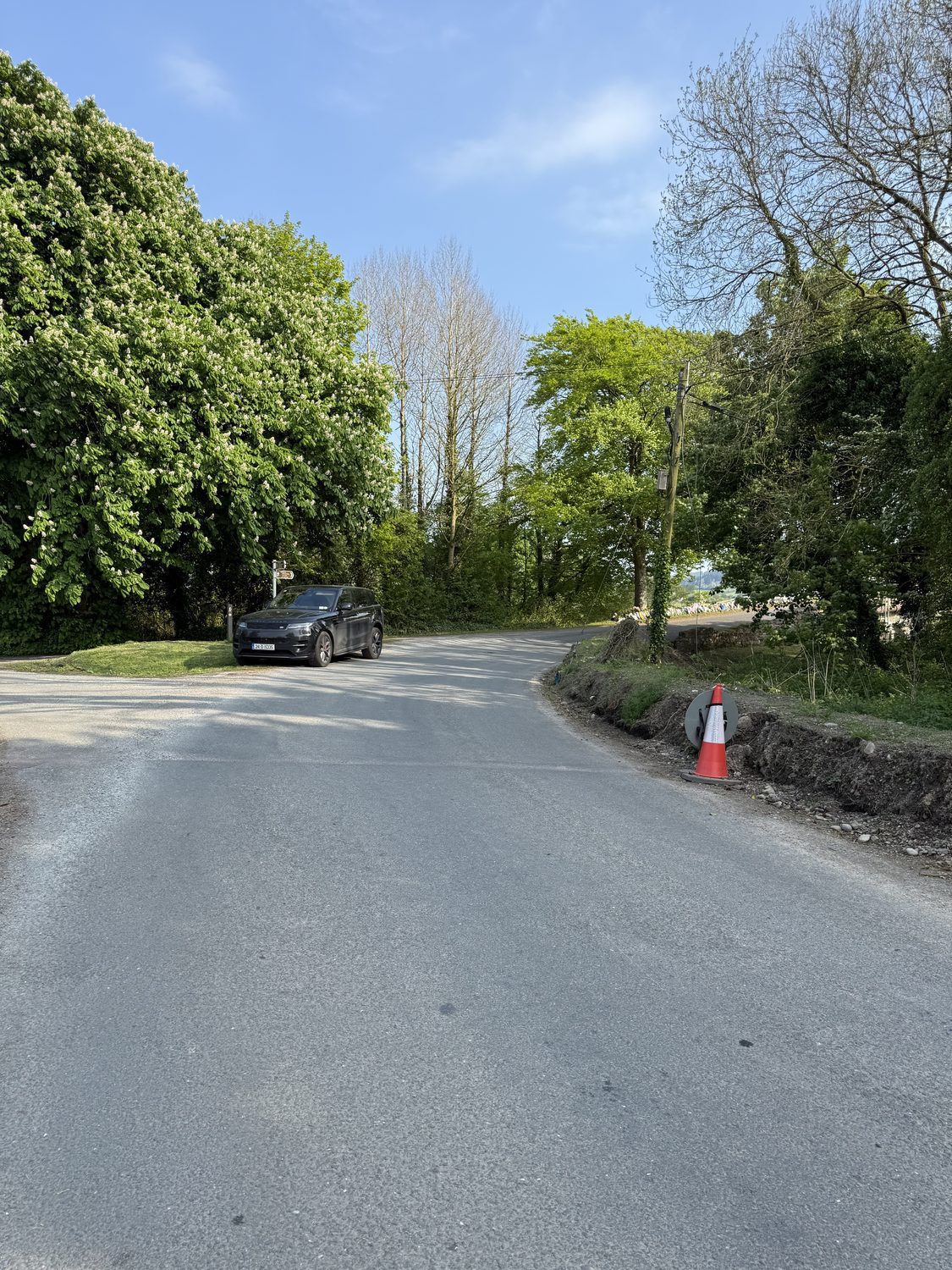
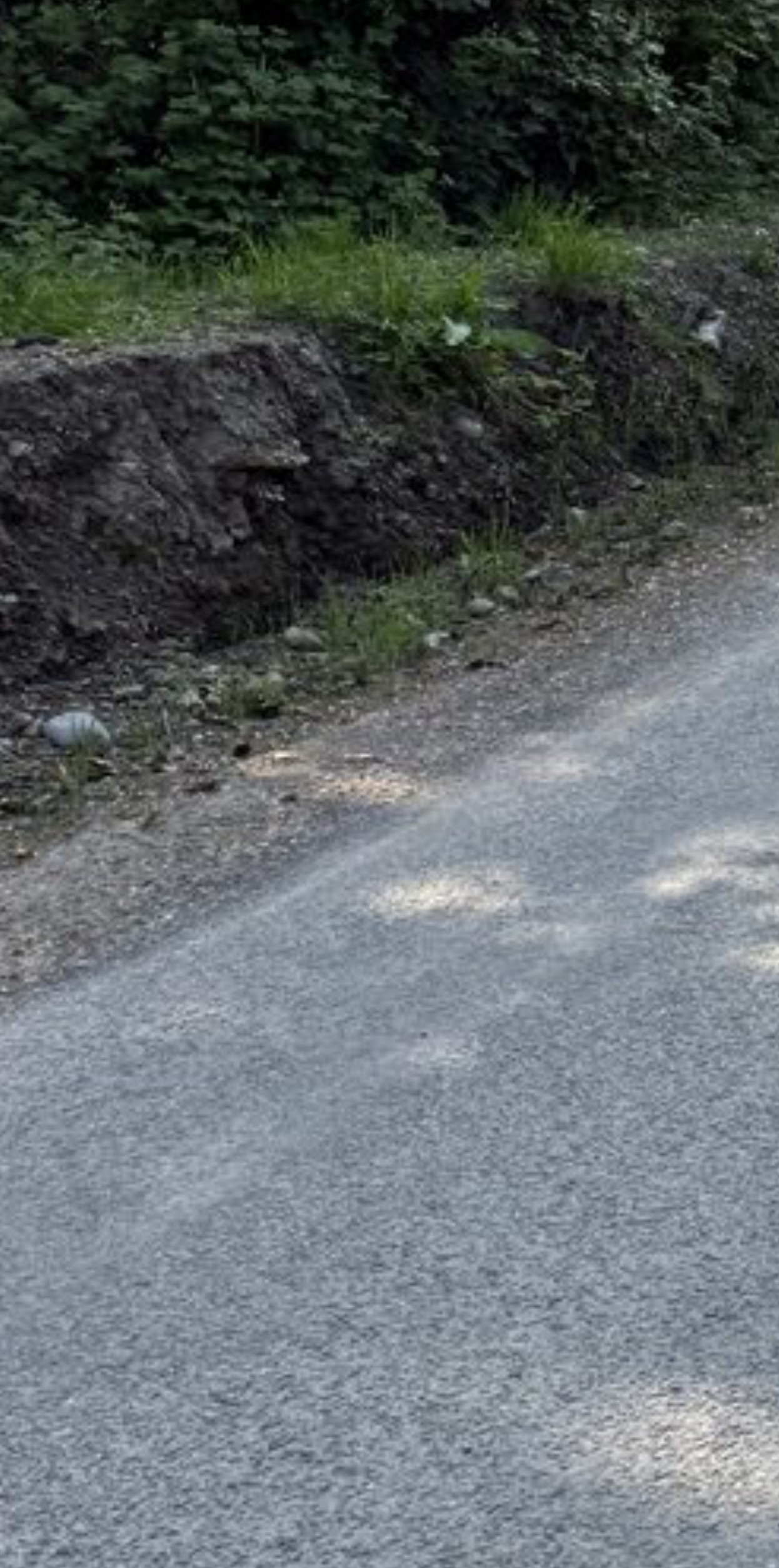
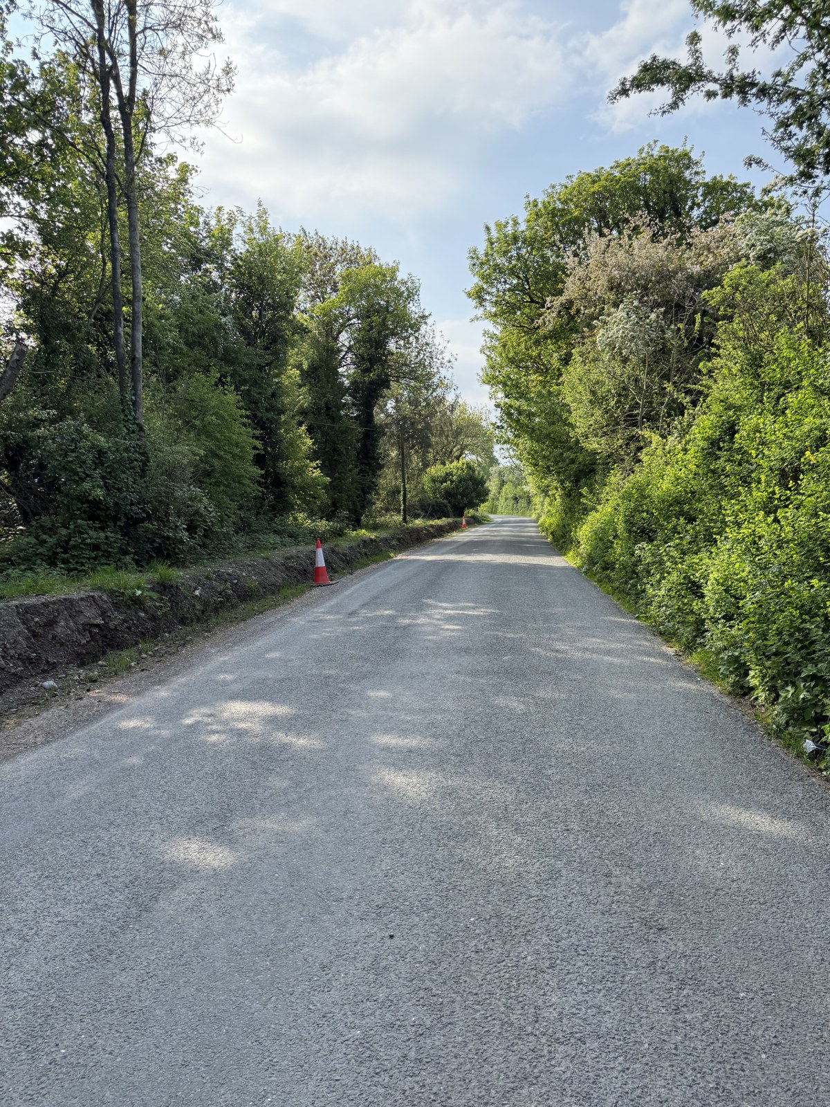
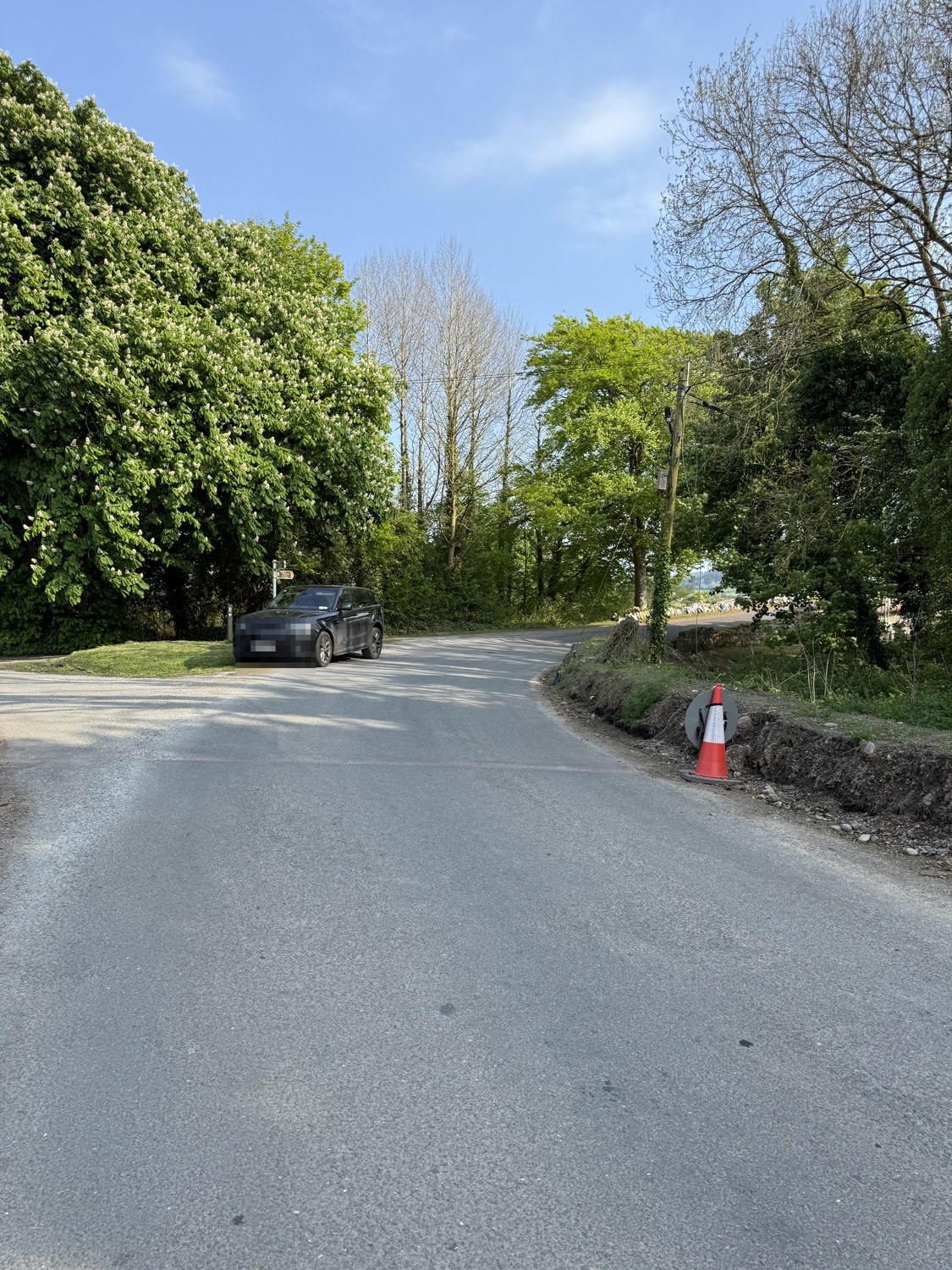
These photographs were taken by the family on 1 May 2025 — a week after Bronagh died — while the road was closed for the forensic examination, and are GPS-tagged at the bridge. They show a freshly-excavated verge and freshly disturbed ground at the site.
The approach — freshly-dug ground along the verge.Family, 1 May 2025 · GPS-tagged at the bridge.A freshly-excavated verge beside the road.Family, 1 May 2025 · GPS-tagged.Enlarged — freshly disturbed soil and loose stones along the verge, at the road’s edge.Family, 1 May 2025 · GPS-tagged.
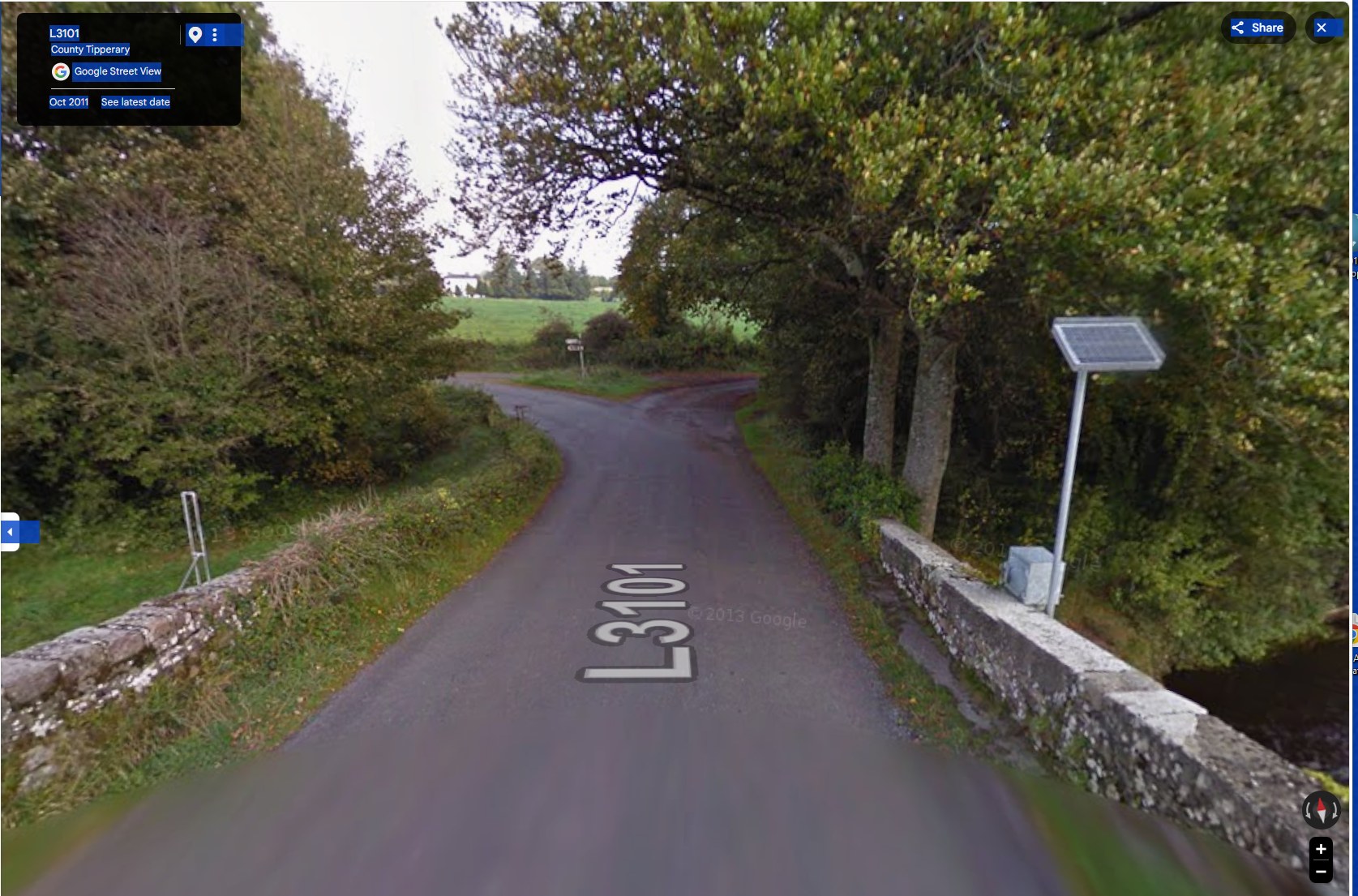
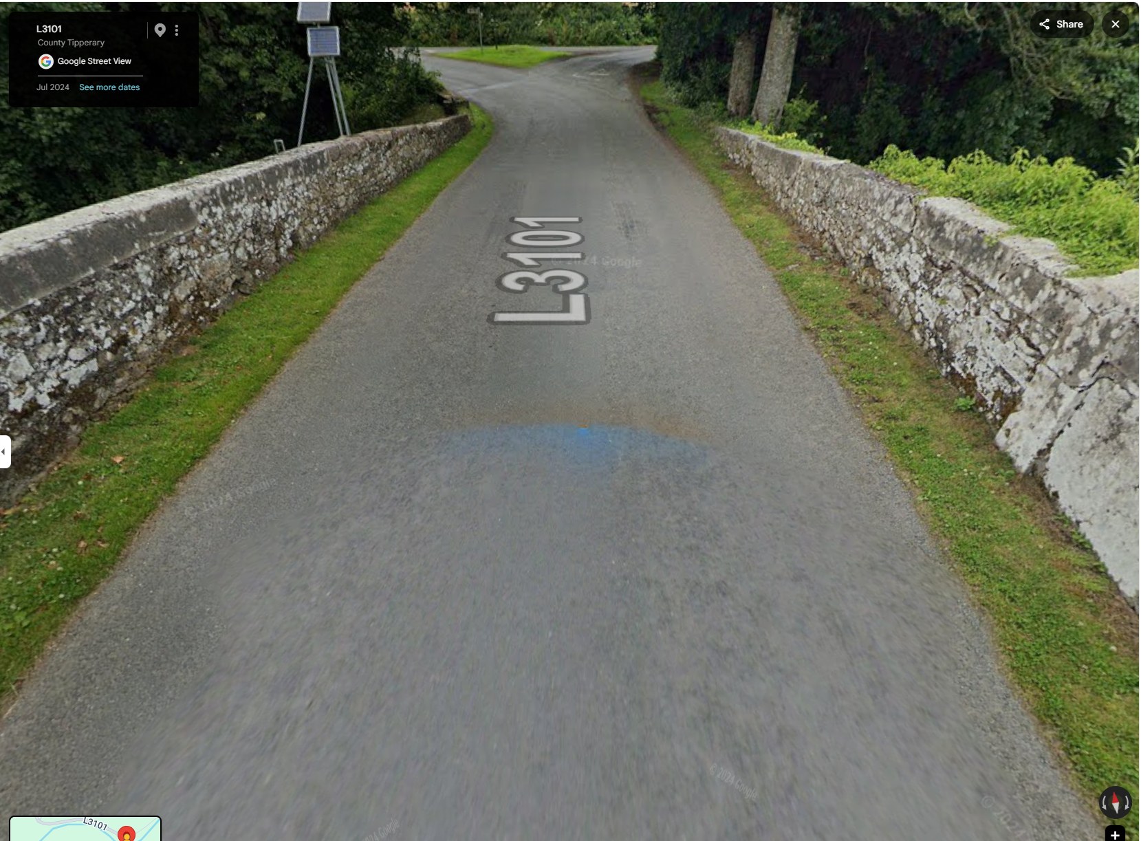
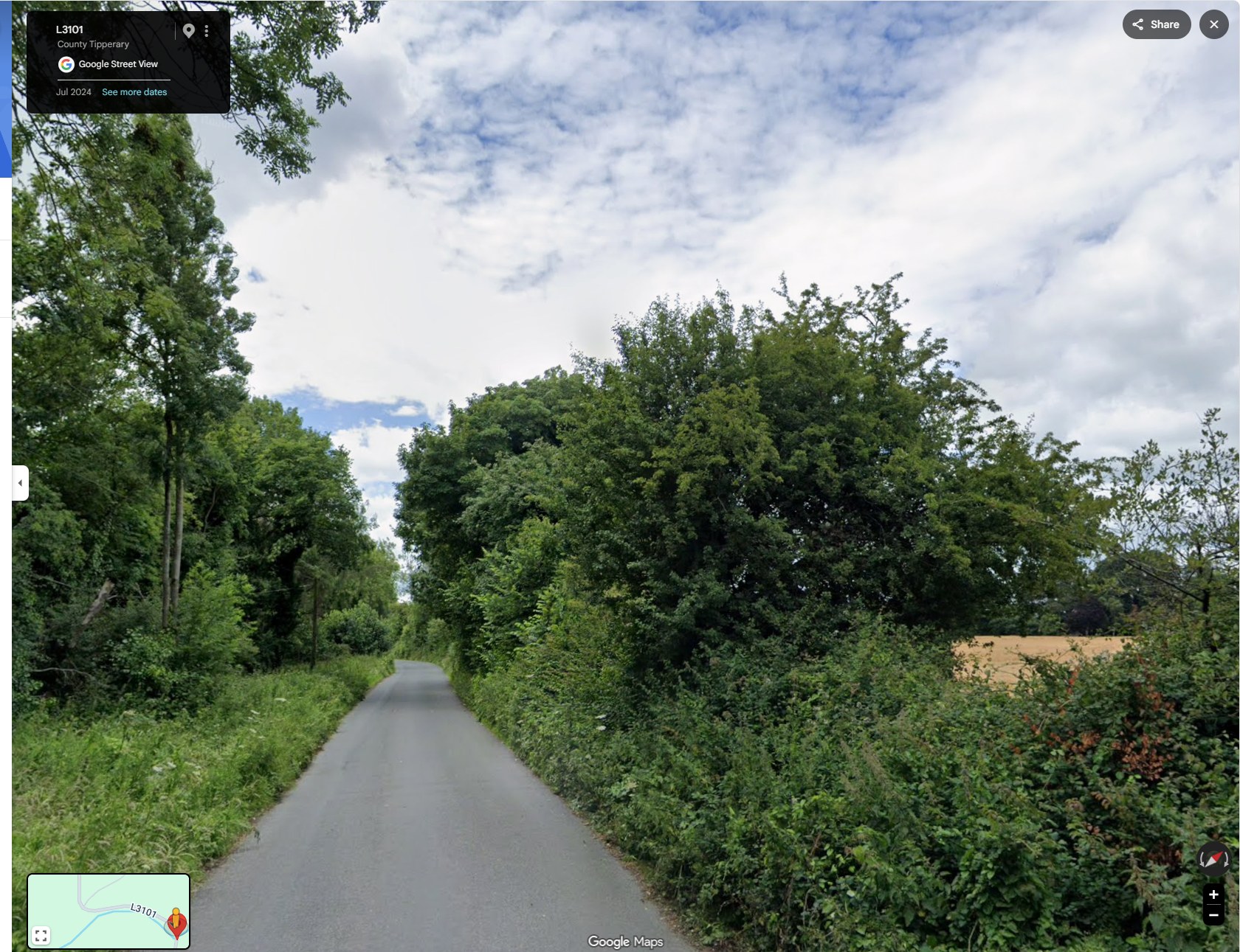
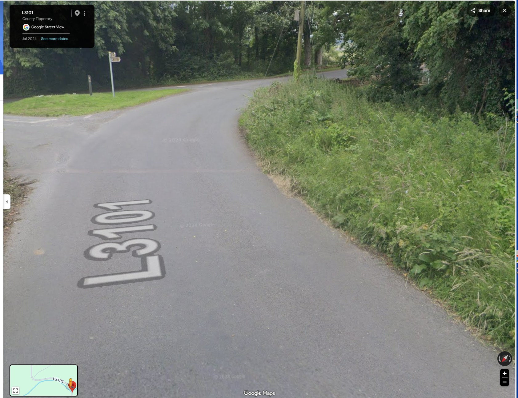
The council’s own works records, disclosed in July 2026, list a road reconstruction on this section in 2018 and a resealing completed in 2025. Google Street View imagery of the same spot, dated October 2011 and July 2024, shows the crossing across that period.
The crossing in October 2011.Google Street View imagery, October 2011.The same view in July 2024.Google Street View imagery, July 2024.
Family photographs, 1 May 2025, EXIF-dated and GPS-located at the bridge. Before/after imagery: Google Street View, dated October 2011 and July 2024. Council account: FOI Internal Review Decision, 18 February 2026 — see the decision; council works records: Road Management works table, FOI 10526 (2018 reconstruction; 2025 resealing). The family’s position on these works is a matter the family is pursuing through their solicitors; no council drainage survey of the site is held. All the photographs of the works, and the 2011–2024 comparison →
The council’s account, against the record
The council said there were no works here. Its own records — and these photographs — do not agree.
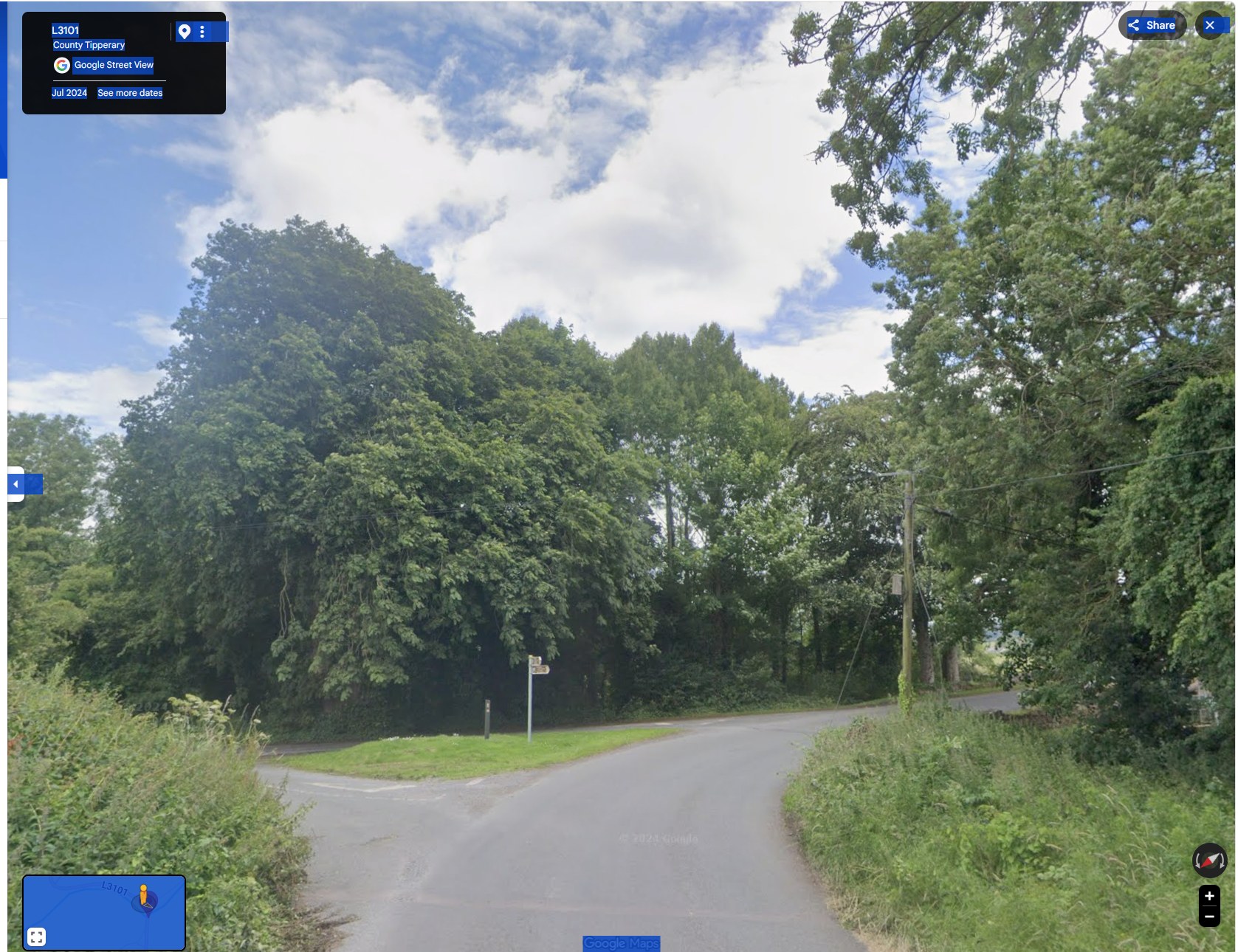
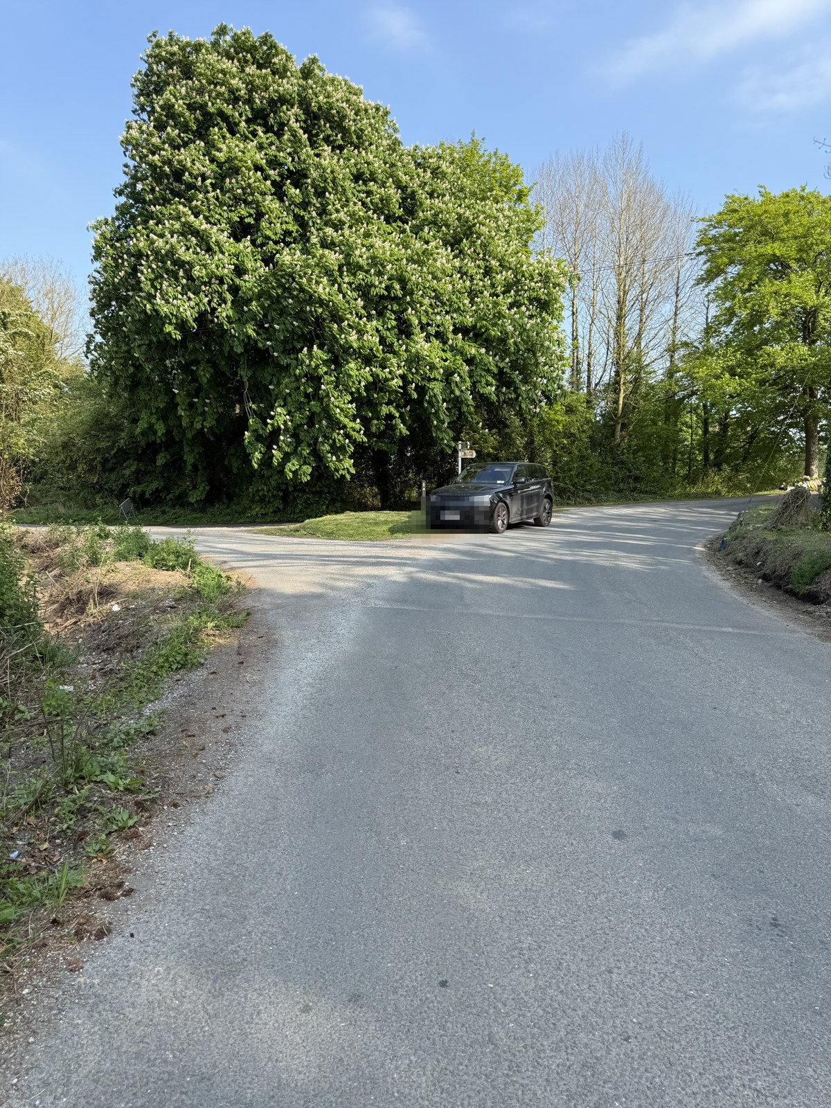
The approach to the bridge in dated records of the same place: Google Street View from July 2024, and the family’s own photographs from 1 May 2025 (the road closed for the Garda forensic examination). Three matched views — each Google capture beside the family’s photograph of the same spot.
The junction
July 2024 — the junction verges overgrown, no trench cut.Google Street View imagery, July 2024 (52.417080, −7.975540).1 May 2025 — the verge cut back to bare soil, the bank disturbed, with vegetation already regrown across the cut ground.Family photograph, 1 May 2025 · GPS-tagged, about 60 m from the bridge. Number plate obscured.
The approach lane
July 2024 — the lane hemmed in by growth on both sides: no cut verge, no clay bank.Google Street View imagery, July 2024 (52.417080, −7.975540).1 May 2025 — the same lane: a clay bank in place along the left, the growth cut back, the road resurfaced.Family photograph, 1 May 2025 · GPS-tagged, about 60 m from the bridge.
The turn just before the bridge
July 2024 — the turn just before the bridge, the verge heavily overgrown: no clay bank.Google Street View imagery, July 2024 (52.417080, −7.975540).1 May 2025 — the same turn: a cut clay bank along the right edge, clay and stones at the road’s edge, the bridge beyond.Family photograph, 1 May 2025 · GPS-tagged, about 60 m from the bridge. Number plate obscured.
What the council was asked — and exactly what it said. Under Freedom of Information, the family’s solicitors asked Tipperary County Council for, among other records, “all documents arising out of drainage works carried out or commissioned at or on Killardry Bridge and/or the L3101 approach road to Killardry Bridge, Kilmoyler … from 2000 to date” (FOI request 106/25; internal review FOI 174/25, Roads Ref FOI 02/26).
In its Internal Review Decision of 18 February 2026, the council answered, in its own words: “The only drainage works that were carried out on the L-3151 consisted of inlets in the roadside verges being cleaned out. … There were no specific drainage works carried out on the bridge itself.” It described the 2025 roadworks on the L-3151 as “to the northwest of the bridge location.”
Request: FOI 106/25 (decision 7 October 2025 — three documents disclosed, no works, drainage or maintenance records). Answer quoted verbatim: Decision on Internal Review, Kieran Malone, Senior Engineer, Roads & Transportation, Tipperary County Council, 18 February 2026 (FOI 174/25). Held on file — see the decision.
The family’s position is that the dated imagery and their dated, GPS-located photographs show works on the approach to the bridge that this account does not reflect. In the family’s reading of the 1 May 2025 photographs, the vegetation already regrown across the disturbed bank is some two to three weeks old — which would place the ground disturbance before 24 April 2025, the night Bronagh died. The dating and significance of these works are matters the family has put on the record and is pursuing through their solicitors.
The questions the family is asking
The council was asked, under Freedom of Information, for the records of works on this road. It answered that there were “no specific drainage works carried out on the bridge itself” and that the 2025 roadworks were “to the northwest of the bridge location.” Yet the council’s own works table records a road reconstruction (2018) and a reseal (2025) on this section; Google’s own dated imagery shows the approach change from overgrown to cut back; and the family’s dated, GPS-located photographs show a fresh clay bank and disturbed ground on the approach.
The family cannot reconcile the council’s account with these records, and is left asking:
Why does the council’s Freedom of Information answer not match its own works records and the dated photographs of this road?
What works were carried out on this road and its approach — and when?
Why do those works not appear in the file the family was given?
These are the family’s honestly-held questions, based on the documents and dated images set out above. They are put to Tipperary County Council, and the family is pursuing them through their solicitors.
Family photographs, 1 May 2025 (EXIF-dated 1 May 2025), GPS about 60 m from the bridge; owner’s vehicle, number plate obscured. The two-to-three-week estimate is the family’s reading of the regrowth, offered as their honestly-held opinion and subject to expert confirmation. Google Street View imagery of the L3101 approach, July 2024. Council quotation verbatim: Internal Review Decision, 18 February 2026 — see the decision.
The family's position
For Bronagh's family, this is the hardest part of the whole record to bear. It was Tipperary County Council's own job to know the condition of this bridge — and it did know. Its own engineers had recorded, twice in the year before she died, and at the council's own expense, that this bridge and its parapet were in a dangerous condition — 'Warning' in June 2024, 'Significant Damage' in January 2025. Yet in the months before and after Bronagh went over that wall into the river, what was pursued for Kilmoyler was climate and flood funding for the road — never, on this record, the repair of the wall that failed her. The family cannot understand how a bridge documented as dangerous by the council's own engineers was not the thing that was fixed, and why — even after Bronagh died there — the funding that was chased was for the road and not the wall. They set this record out, in the council's own words, so that others can read it and ask the same question.
This page quotes reports and public statements from Tipperary County Council's own records, reproduced word-for-word and sourced to each. It makes no allegation of wrongdoing against any named individual; views expressed as the family's are their honestly-held opinion, based on that record and on a matter of public safety. These are matters for the proper legal process; nothing here determines legal liability.